
The Third Street Improvement Project is almost completed – if it seems like it has been a long time – you would be correct. The road has been blocked off for over a year, but the project has been in planning for a decade and a half.
City Engineer Dianna Jensen told the Vanguard on Friday, “This project has had a few delays due to PG&E being called off for the fires and for several days of rain. The current schedule is showing we will be substantially complete by early to mid January.”
She warned that this could change with more rain delays.
Right now the schedule is for them to be working on signal lights over the next three weeks meaning that the intersection of B and Third will be a four ways stop.
Ms. Jensen told the Vanguard, “Stop signs will include flashing beacons to alert motorist, bicyclist, and pedestrians. It is currently anticipated that the new signal will be working the week of January 7th and the road will be open to traffic a day or two  later.”
The original idea dates back over a decade wit the idea of improving “the safety, function, aesthetics, and sustainability of the two-block segment of Third Street between A Street and B Street and the B Street alley in downtown Davis. The purpose is to improve the corridor for pedestrians and bicycles and create a “gateway” between UC Davis and downtown.”
The city had a Master Plan put out in 2011. But it stalled due to lack of funding. On December 13, 2013, the Vanguard ran a story announcing that the city had received $1.9 million in SACOG funding for Third Street.

In the city’s release, “the Third Street Improvements (B Street to the UC Davis campus) stem from a community outreach process that was completed in 2011 to redesign 3rd Street to better serve its primary users: pedestrians and bicyclists.”
But four years later, most of this had not happened. The city then put out a release in the summer of 2017. It noted that the project was “a multi-year multi-phased effort that was initially approved for preliminary engineering and corridor planning in the 2006/07 FY.”
The initial design was complete in 2008-09 but “the project was delayed for a few years due to uncertainty about how to fund the project, in part due to the economic impact of the housing market collapse.”
In 2012-13, work began to move forward on Phase I which replacing aging existing underground water pipelines and then the undergrounding of overhead electric and communication lines (Phases II and III) in conjunction with PG&E, AT&T and other overhead utilities.
The city then obtained a $3.3 million Federal STIP grand for the corridor improvements.
The city then warned, before the street improvements could be installed (Phase V), the city needed to improve the reliability of the infrastructure “to support current and planned mixed use infill, and improve stormwater drainage to reduce localized flooding while employing sustainable stormwater quality management practices in the Downtown.”
Phase IV was to take place from August 2017 to November 2017. But that also got pushed back due to funding delays.
“We didn’t get awarded fast enough,” City Principal Civil Engineer Michael Mitchell told the Aggie last year. “The contractors have been very good, actually ahead of schedule. We wanted it awarded earlier, but it just didn’t happen due to issues outside of our  control. The current project should be done by the end of the calendar year, before Christmas. And then we should have the main project — the main event — out to bid and awarded in the early part of next year in time for a spring construction.”
Then Phase V will “consist of pavers along the street and sidewalk in a circular pattern, an art piece on the east end, new street lighting, bike racks, and benches.”
What will emerge is the idea “of increasing the amount of “real estate” along these sidewalks along this particularly narrow sidewalk was explored along with the goal of creating a better experience for bicyclists.”
The idea is that there will be more room for pedestrians. Bikes will also be prioritized.
The problem that many have cited is the businesses along the corridor have been heavily impacted by the long construction. These include: Raja’s Tandoor, Ali Baba, 3rd and U Café, Sharetea and Pho King 4.
The final product will have circular patterns of pavers along the street and sidewalk, an art piece on the east end, and new street lighting, bike racks and benches.
Ultimately this is seen as a way to “activate” the area between UC Davis and downtown, bring more people into the core, and form a connection between the university and downtown.
The problem as we have seen, while the work began in 2012-13, the funding, now toping $9 million mostly from external sources has been hard to secure and the delays have turn this into a much longer project than originally envisioned.
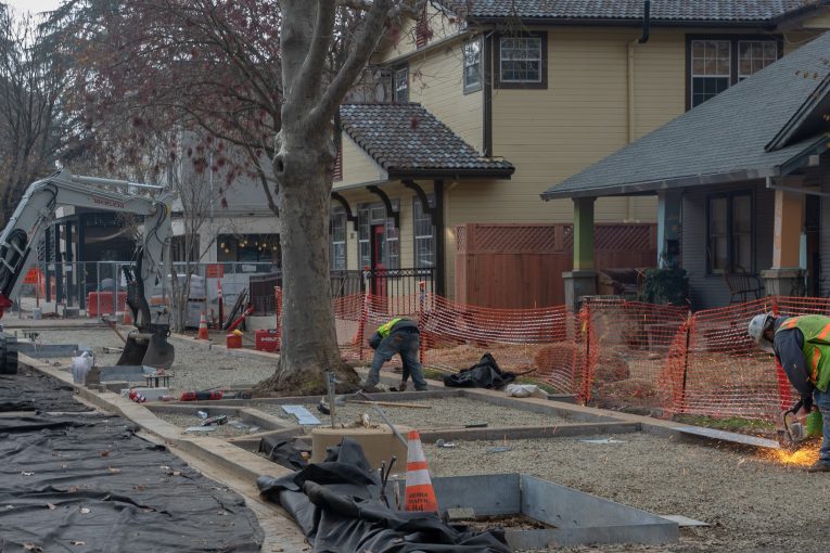
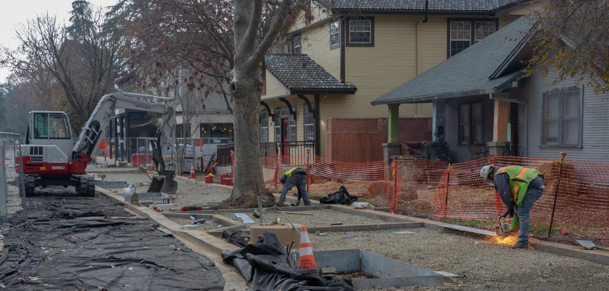
Here’s what it looks like now…


—David M. Greenwald reporting

Depending upon when the approved development projects begin, and what else is approved, the city is going to be a semi-permanent construction zone.
Looking forward to seeing how this plays out at Richards/Olive (e.g., due to Lincoln 40 and the traffic “improvements”), University Mall, etc.
Not to mention the entire downtown, one painful redevelopment at a time – if some have their way. 🙂
And the problem with that, other than “loss of stasis” is what?
Guess to avoid your apparent concern, we should not replace water mains, underground OH utilities, improve drainage, or maintain streets… let the second law of thermodynamics play out… I’d rather not go that route… costs more in the long run…
Howard: The “good news” is that no one will even notice if future picnic day revelers block the streets. 😉
I guess we got spoiled by years of no funding for road repairs.
Repairs are different from “improvements” needed to accommodate new developments. In fact, additional repairs/maintenance will be needed as a result of the increased construction and regular traffic from those new developments. (Starting with the heavy equipment on existing roadways, needed for construction.)
How much is the city getting from that new gas tax?
Most of this project was infrastructure repair. The last stage was a reconfiguration.
Maybe in your mind… will concede that… not how the words are used in the real world… “improvements” include fixing things that are failing…
Will be charitable, and assume your “jargon” (or, ” inherent bias”) was formed outside the real world… accountants are one group that does that…
What you seem to describe (unclear) is typically known as “expansion”.
Done.
סיימתיסיימתי
[moderator: please stop being offensive. Ok?]
Thank you, moderator.
Repairs maintain existing infrastructure. “Improvements” are generally expansions to accommodate more development.
Seems to me that the vast majority of SACOG funding is for “expansion” of infrastructure. (And, will quickly be overcome by new development. With taxpayers picking up the tab, vs. the developments that are creating the additional need.)
Four of the five phases was repairing existing infrastructure, the fifth was a reconfiguration of the existing street after the infrastructure repairs.
David: At the very least, one of the “improvements” was to accommodate the possibility of new mixed-use developments, according to your article.
However, my comments were more general in nature. SACOG “improvements” are primarily intended to force taxpayers at large to subsidize improvements needed for new developments.
This is probably one of the reasons that many communities throughout the state have “failed” to meet “fair share” growth guidelines, in the past. (They didn’t want the growth/development to begin with, so there was no need for corresponding “improvements”.)
Do you have any figures, regarding the percentage of communities statewide that have failed to meet those guidelines, in the past? I understand it’s a very significant percentage. Of course, this is all changing, as a result of additional state interference.
Hard to know what is going to happen there. At the time that was written they were coming off the B St Visioning Process. That idea at that time was to take single story bungalows and redevelopment them. But there was no mechanism to that. We’ve seen a few changes Central Park West and Mission Residence, but not much else. What occurred at Third St really isn’t dependant on other changes.
How much did the city contribute toward this? And, are they anticipating zoning changes that haven’t even been approved?
Please remind me again, why taxpayers (at any level) are subsidizing private developments. (And not just related to this one project.)
For example, it seems to me that the vast majority of SACOG funding is intended to support and facilitate new developments at taxpayer expense. (I’ve forgotten exactly where they get their money from.)
https://www.sacog.org/sites/main/files/file-attachments/fy_2018-19_final_budget_.pdf
Because there is no longer any vehicle access to those 3rd St businesses, we can no longer visit them. The city wants us all to walk or ride our bikes, but at age 70 with bum knees and feet, we can no longer do that. Sad.
In regards to “permanent construction zone” and related, hopefully future projects of this magnitude look better from the outside – clear, organized signage etc, more focus on promoting businesses with egress issues – including better directions for the detoured – in the case of 3rd St. many with UC Davis destinations did not know that e.g. 2nd St. was an alternative, and last but the opposite of least, any detour with a route which changes street classifications – in this case 3rd St. is a local st, and B St. a minor arterial – would add safety measures, such as temporary barriers on B St and some kind of temporary signal or changed priority on B St. and 2nd.
To help make this happen it’s been arranged that a BTSSC member will be present at capital project meetings where detours etc. for major projects are organized. I will be the first one to participate – my preliminary review of the MUTCD in relation to 3rd shows that the signage and routing did not follow the best guidance. However, to their credit Public Works – gently pressured by Bike Davis – recently agreed to move a sign on B St. north of third out of the bike lane, encumbering it less but still providing clear communication.
Todd, and all others, please do not use acronyms without first spelling out the full name. Not all of us live and breathe the city commission beat. Without looking it up, BTSCC is something akin to the Bicycle, Transportation and Safety Something Committee? But what the heck is MUTCD?
In any case, a year after all of these improvements and repairs are completed, nobody will ever remember how annoying they were.
Manual on Uniform Traffic Control Devices