 by Matt Williams
The Dream: “To share a growing awareness that the preservation of open space, much like the operations of our schools and libraries, is an essential community goal, which will not be accomplished without our sustained support.
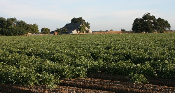
On Nov. 7, Davis citizens will have an opportunity to vote for Measure O – a City of Davis ballot measure which will provide the funding necessary to enable our city to enhance our own quality of life by creating wildlife habitat reserves, with areas set aside where Davis citizens will be able enjoy strolling, bicycling, bird watching and bringing their children. And we will be slowly creating a green buffer to help define our city limits. Davis citizens of all ages will have the opportunity to leave a lasting legacy to future generations.” (Source).
The Vision
In November 2000 at the same time as the passage of Measure O, the City was in the midst of a General Plan Update that was adopted in May 2001. Building on the new General Plan and Measure O, the City Council adopted a resolution outlining a planning process to (A) establish open space acquisition priorities and management goals, (B) refine City open space priorities and (C) establish a framework plan to guide future acquisition and management decisions. The result of this effort was the 2002 Davis Open Space Acquisition and Management Plan (the A&M Plan), which built on the 1989 Davis Greenway Plan. Following City Council adoption of the A&M Plan, the Council also adopted an acquisition priorities map shown below.

The A&M Plan identified the following different types of open space categories for spending Measure O funds:
- Urban Fringe: Open space lands that help define the urban limits of Davis and provide an adequate buffer between urban and rural land uses.
- Urban Separator: Open space lands that separate Davis from neighboring cities to preserve the unique character of each community.
- Agriculture: Prime agricultural lands that maintain the long-term viability of agriculture in the Davis Planning Area.
- Biological and Natural Resources: Important wildlife habitat and lands for sensitive species and other significant natural resources
- Scenic Resources: Lands that provide views of significant landmarks and community gateways.
Early Accomplishments
Since 2000, the City has protected 2,513 acres at a cost of $4,566,000 — $6 million less than was projected in the A&M Plan. The reasons for the lower cost per acre are numerous. Two of those reasons are noteworthy, (1) all but one of the parcels do not allow public access and (2) as is shown by the graphic below, none of the parcels (shown in green) fall into the Urban Fringe category.

As described in the following news release by UCD, the successes are noteworthy for their inter-jurisdictional and inter-agency collaboration
September 2004 — Agricultural Land to Be Preserved Along I-80 Corridor — “It takes a village to save a farm. Two cities, a county, a land trust, a university, the state of California and the federal government have joined forces to preserve agricultural land. […] The seeds of this idea were planted in 1999 when the cities of Davis and Dixon adopted a joint resolution declaring the intent to establish an open-space agricultural and natural habitat buffer between the cities. […] Said UC Davis Chancellor Larry Vanderhoef. “We are delighted to facilitate the preservation of this land in partnership with our neighbors.” (Source).
However, the inability to achieve any traction in the Urban Fringe category did not go unnoticed. In the June 2006 City Council Candidates Forum, the following was one of the questions . . .
“When Measure O, the open space protection initiative, was passed voters believed that one of the priorities was to obtain and protect agricultural and open space lands surrounding Davis. The current City Council effectively removed that priority in favor of obtaining lands farther removed from the city borders. If you are elected to the City Council would you be willing to reconsider this issue? How do you envision the City using Measure O funds in the future?”
. . . and one of the candidates, Mike Levy, submitted the following answer to the question.
“I would try to find ways to leverage public money by working with the Yolo Land Trust, Yolo County , Solano County , UC Davis, and other relevant governmental and non governmental organizations. Projects that I would look to as models in this regard are the McConeghy Ranch property at Kidwell (which created a development-free zone between Davis and Dixon, an agricultural buffer, and bicycle paths between the two cities), and the Dowling Farm Preserve (which preserved 650 acres between Woodland and Davis, including Swainson’s Hawk habitat, in an agreement between the Yolo Land Trust, Woodland, and Dowling). These private/public ventures could present tremendous opportunities not available through public efforts alone. (Source).
How Have We Done?
Davis has much to be proud of. We have protected, directly or through partnerships, over 4,900 acres of sensitive wildlife habitat and farmland. Davis has been very successful at acquiring federal and state funds and grants. The League of California Cities has honored Davis with an award of excellence in land use and environmental quality. The San Francisco Bay Estuary Project honored the Davis Wetlands project as the best integrated conservation and management plan.
What Haven’t We Done?
As noted earlier, the dream of controlling our Urban Fringe, the open space lands that help define the urban limits of Davis and provide an adequate buffer between urban and rural land uses is still only a dream. The yellow areas in the graphic below do a good job of illustrating our Urban Fringe. The blue areas on the right side of the graphic are the FEMA 100-year flood plain.

Where Do We Go From Here?
I’m going to hold that question until tomorrow to let everyone digest and comment on and ask questions about the information provided above.

Matt thanks for the piece and the offer to ask questions. Here is my first..
What exactly are the yellow areas?
So all the white areas where acquired with/or in part with Measure O Funds?
Matt – Thanks for this. I don’t have time to write today but I look forward to tomorrow’s continuation. You offer plentiful links to primary sources and I appreciate that. Can you provide links to:
2002 Davis Open Space Acquisition and Management Plan (the A&M Plan)
1989 Davis Greenway Plan
Disregard last question, I was misreading the key.
So who owns all the land south of Davis (between Putah Creek and South Putah Creek). Is that Yolo or Solano County?
B. Nice, the map with the yellow includes parcel boundary lines, All the yellow parcels and all the white parcels are agricultural farmland that is currently owned by private individuals without any Ag Conservation Easement in place. The reason that some of those parcels are yellow and some are white is that I had information about the yellow parcels that indicated that the owners might be willing to consider placing an Ag Conservation Easement on their farmland if the price was right. For the parcels that are still white I either knew that the owner was not receptive to the idea of such an Ag Conservation Easement, or I had no information that would allow me to say whether they would or wouldn’t be willing.
Note: my efforts concentrated on the area north of I-80 (Yolo County) and all the parcels south of I-80 fall into the “I have no information that would allow me to say whether they would or wouldn’t be willing” category.
The red and white cross hatched areas are 1) the Innovation Park Task Force identified acres on the east and 2) the nnovation Park Task Force identified acres on the west expanded to include the Class IV Alkalai soils that Don Shor has indicated that A) are very poor farmland and 2) would not be likely to be targeted by the OS&H Commission for preservation with Measure O funds.
B. Nice said . . .
[i]”So who owns all the land south of Davis (between Putah Creek and South Putah Creek). Is that Yolo or Solano County?”[/i]
Almost all the land to the west of Mace Boulevard is in Solano County and I do not have any ownership info on that land.
Some Thoughts:
(1)The City of Davis and 544 other American cities are members of ICLEI ( http://www.iclei.org/index.php?id=1387®ion=NA ). ICLEI, originally known as the International Council for Local Environmental Initiatives, is a private, non-profit foundation dedicated to helping local elected officials (mayors, city councilmembers, etc.) implement regional and international planning. Because of unfavorable local reaction to a variety of ICLE’s “Sustainable Development” and “Innovative Development” proposals to regulate the environment (Marin County’s response to The One Bay Area Plan is a recent example), ICLEI has had to rebrand itself as “Local Governments for Sustainability”. A major theme of ICLEI is to push local communities to regulate the environment in response to climate change. One of the favorite themes of ICLEI is to recommend that the community hire a full time “sustainability manager,” to implement their policies.
(2) Is any of this going on in Davis?
[u][b]The “D”s, from the ICLEI List I Referenced Previously
[/b][/u] Dakota County, MN
Dallas, TX
Danville, CA
Davis, CA
Decatur, GA
Decorah, IA
Dedham, MA
Delray Beach, FL
Denton, TX
Denver, CO
Des Moines, IA
Devens, MA
DeWitt, NY
Dixon, CA
Dobbs Ferry, NY
City of Duarte, CA
Dublin, CA
Dubuque, IA
Duluth, MN
Dumfries, VA
Durango, CO
Durham, NC
[quote]All the yellow parcels and all the white parcels are agricultural farmland that is currently owned by private individuals without any Ag Conservation Easement in place. [/quote]
First, thanks for your above clarification. Another question, what exactly is a “Ag Conservation Easement”?
Okay I googled it and got the answer:
[quote]”An agricultural conservation easement is a voluntary, legally recorded deed restriction that is placed on a specific property used for agricultural production. The goal of an agricultural conservation easement is to maintain agricultural land in active production by removing the development pressures from the land. Such an easement prohibits practices which would damage or interfere with the agricultural use of the land. Because the easement is a restriction on the deed of the property, the easement remains in effect even when the land changes ownership.”
[/quote]
So this is my next question,
[quote]The reason that some of those parcels are yellow and some are white is that I had information about the yellow parcels that indicated that the owners might be willing to consider placing an Ag Conservation Easement on their farmland if the price was right. [/quote]
To clarify when you say the “price is right”, the city would pay landowners to legally set aside a designated area of their land for agricultural purposes use only? But the city itself does not own the land or have any other legal control of the land?
B. Nice: “[i]To clarify when you say the “price is right”, the city would pay landowners to legally set aside a designated area of their land for agricultural purposes use only?[/i]”
One way to think about it is the property owners are selling the development rights to their property, not the property itself. The City (or other entity) pays the property owner for those rights, and places an easement on the property blocking development in perpetuity. Even if the land is later sold to another buyer, the easement preventing development remains in force.
[quote]The City (or other entity) pays the property owner for those rights, and places an easement on the property blocking development in perpetuity.[/quote]
If the city changes it mind, can the landowner “buy back” these development rights if they wish? Basically are these development rights considered an asset for the city (or other entity)?
“If the city changes it mind, can the landowner “buy back” these development rights if they wish? Basically are these development rights considered an asset for the city (or other entity)?”
as it was explained on tuesday, the way that they are going about funding the easements, these are pretty much permanent.
matt has clearly put a lot of work and thought into this, but i think what he has here is the outcome of a long and engaged general plan process rather than simply the work of one person who is getting the buy in of several.
[quote]as it was explained on tuesday, the way that they are going about funding the easements, these are pretty much permanent.[/quote]
So they are not worth anything in a finical sense?
Does permanent mean “permanent”. The city can’t sell the rights back to the owner? (even if the profits would be used to but another easement for example.)
Conservation easements are usually transferred to or held in conjunction with another entity like the Nature Conservancy or the Yolo Land Trust. My understanding is that unwinding a conservation easement is a practical impossibility.
As Jim Frame noted, the easement are permanent, which is exactly why they should not be placed on an the immediate urban fringe that may well be an important future development area. If they are to be used, they should be placed out from the fringe, to provide a permanent ring boundary – not unlike the greenbelt between Woodland and Davis.
Zoning, not conservation easements is the appropriate control for cities and counties to use to control growth.
[quote]My understanding is that unwinding a conservation easement is a practical impossibility.[/quote]
That is what makes them so effective for establishing an urban growth limit. Much, much more effective than zoning.
So is all land with the green stripes already in a conservation or agriculture easement ?
Sorry read the key wrong again:-(. What’s the deal with the land that’s is drawn through with green marker?
Dr. Sokolow provides a good overview of the tools available for protecting farmland and open space here (pdf): [url]http://www.des.ucdavis.edu/faculty/handy/ESP171/POLICIES.pdf[/url]
The harder it is to take the land out of a particular status, the more effective it is as a longterm conservation tool.
Robb Davis said . . .
[i]”Matt – Thanks for this. I don’t have time to write today but I look forward to tomorrow’s continuation. You offer plentiful links to primary sources and I appreciate that. Can you provide links to:
2002 Davis Open Space Acquisition and Management Plan (the A&M Plan)
1989 Davis Greenway Plan”[/i]
Here you go Robb.
[url]http://toolkit.valleyblueprint.org/sites/default/files/08_davis_osamp-final.pdf[/url]
and
[url]http://lda.ucdavis.edu/people/websites/francis/designwork/greenway.html[/url]
Don Shor said . . .
[i]”My understanding is that unwinding a conservation easement is a practical impossibility.
That is what makes them so effective for establishing an urban growth limit. Much, much more effective than zoning.”[/i]
I agree 100% Don. That is my understanding as well . . . which makes the yellow areas in the graphic very powerful indeed.
[quote][quote]The harder it is to take the land out of a particular status, the more effective it is as a longterm conservation tool.[/quote][/quote]
[quote]That is what makes them so effective for establishing an urban growth limit. Much, much more effective than zoning.” [/quote]
[quote]I agree 100% Don. That is my understanding as well . . . which makes the yellow areas in the graphic very powerful indeed.[/quote]
I’m worried these arguments will be used by people opposed to creating more easements.
[quote]I’m worried these arguments will be used by people opposed to creating more easements.[/quote]
They will be. And it’s an important debate to have. I think it would be perfectly reasonable to put the longterm conservation of agricultural land, open space, and wildlife habitat before the voters again. A discussion about the tools used for that purpose, such as I linked above, and the relative efficacy of those tools would be an important part of that.
Conserving ag land and open space is presently part of our fundamental planning documents in the city and county. If there are those who disagree with that, perhaps it’s time to revisit those principles and practices.
don: my read is that there are not those who disagree on the fundamentals, they disagree on the margin and how much and where.
[quote]Conserving ag land and open space is presently part of our fundamental planning documents in the city and county. If there are those who disagree with that, perhaps it’s time to revisit those principles and practices.[/quote]
I was going to say didn’t we just hash through all this when we voted on Measure O, it feels like that was just a few years ago, has it really been 13 years?
[quote]don: my read is that there are not those who disagree on the fundamentals, they disagree on the margin and how much and where.[/quote]
Part of me feels, in order to keep the wolves at bay, we should save easements for margins (some of the yellow land would already be inside the margins) and use zoning for internal farm land.
B. Nice said . . .
[i]”What’s the deal with the land that’s is drawn through with green marker?”[/i]
That area is dark green as a result of the green color that indicates “Fee Title Property” over laid by the blue of the FEMA 100 Year Flood Plain. The blue and the green combine to make dark green.
Said another way that land (Howatt Ranch) is owned outright by the City of Davis and is also in the FEMA 100 Year Flood Plain.
NOTE: The graphic you see is the combination of (A) a June 2013 City of Davis document called “Publicly Managed or Monitored Lands” that I got from Bruce Boyd, who is part of the IT Department at the City, and (B) my own free-form artwork with yellow and blue felt-tipped pens,
NORE2: Bruce is in the process of making an electronic version of this map. One of the shortcomings of my effort is that I only show the Flood Plain on the east side of town. Bruce’s electronic version will include the Flood Plain areas for the west and north-central areas.
B. Nice said . . .
[i]”I’m worried these arguments will be used by people opposed to creating more easements.”[/i]
I posted the following in both the Relativity thread and the Mace 391 thread yesterday, and it addresses your worry.
Rob White said . . .
[i]”As we discuss the economic health and sustainability of Davis over the coming weeks, months and years, we will each observe the dialogue from a different viewpoint. And though we can all do our best to stick to the facts and figures of the topic, each of us will be influenced by our own experiences.”
[/i]
The logical next step to Rob’s perspective above is that “Reasonable People can agree to differ reasonably.”
I like to think that Davis has more than its fair share of reasonable people, but given the passionate level of community debate in Davis . . . passion that often produces dialogue that to the outsider appears unreasonable . . . I believe we need to heed Rob’s words above even more strongly and more diligently. Taking time to “walk in the other person’s shoes” is a good place to start. Looking for solutions that provide broad benefit. Trying to balance the many competing “What’s In It For Me” (WIFM) drivers of the diverse audiences that make up Davis.
Over the past few weeks I’ve been spending a lot of time working on transforming Davis’ dream of a permanently conserved Ag Farmland Boundary as envisioned by Measure O into a reality of upwards of 3,000 acres of prime ag land conserved, two riparian corridors rehabilitated, and the restoration of salmon spawning habitat in the Putah Creek complex enhanced and expanded.
Depending on your own personal views, that effort could be simply a single perspective, or as many as three perspectives.
Another way to look at the same activities is as a series of discussions with the various parties who have an interest in an Integrated Ag Farmland Preservation/Innovation Park Creation Strategy.
Yet another way to look at it is an effort to focus on “Yes” rather than “No” with all the core constituencies getting positive answers to their individual “What’s In It For Me” questions.
By walking in the other persons’ shoes the effort ends up with the following multi-perspective components:
— The Farmland Preservation portion of the Davis community would see the dream of a conserved agricultural border transformed into reality, with upwards of 3,000 acres of prime ag land conserved.
— The Riparian Habitat portion of the Davis community would see two riparian corridors rehabilitated.
— The Fish Spawning Habitat portion of the Davis community would see the efforts to restore salmon spawning habitat in the Putah Creek complex enhanced and expanded.
— The economic vitality community in Davis would see upwards of 950 acres of Innovation Park identified that would put Davis in a position to be proactive about keeping good companies in Davis rather than losing them to other cities/states.
— The Ag Technology Research community spinning out of UCD would see well over 1,000 acres of permanently conserved ag land made available for field research adjacent to the Innovation Parks (as in the current Harris Moran model on south Mace and the Bayer/AgraQuest model just committed to in West Sacramento).
— The taxpayers in Davis would see additional revenues generated by the increase in economic vitality that comes with retained/added jobs that match the UCD/Davis core competencies profile. As a result further tax increases should be forestalled.
— Thousands of individual Davis residents would see their homes that are currently in the FEMA floodplains removed from the risk of flooding, saving them whatever annual FEMA flood insurance premiums they are paying.
I’m sure there are other perspectives that the seven bullet points above don’t capture, and I’m equally sure that as the open, transparent community dialogue continues, those perspectives will step up and be heard. That dialogue is what the public commenters were asking for on Tuesday . . . open, transparent, well-informed community dialogue. We owe that to ourselves.
FULL DISCLOSURE: I was one of the public commenters on Tuesday.
Here is the Yolo County Flood Zone Map:
[url]http://www.yolocounty.org/Index.aspx?page=577#[/url]
Please note that being right in the 100-year zone has not kept Woodland from developing a wide range of land uses on the north and east sides.
B. Nice said . . .
[i]”I’m worried these arguments will be used by people opposed to creating more easements.”[/i]
Don Shor said . . .
[i]”They will be. And it’s an important debate to have. I think it would be perfectly reasonable to put the longterm conservation of agricultural land, open space, and wildlife habitat before the voters again. A discussion about the tools used for that purpose, such as I linked above, and the relative efficacy of those tools would be an important part of that.
Conserving ag land and open space is presently part of our fundamental planning documents in the city and county. If there are those who disagree with that, perhaps it’s time to revisit those principles and practices.”[/i]
I fundamentally agree with you Don. Where we partially depart from one another is in your concluding paragraph. “Conserving ag land and open space” [u]is absolutely part[/u] of our fundamental planning documents in the city and county, [u]but it isn’t the only part[/u]. As in all things in life there are competing alternatives and tradeoffs in our fundamental planning documents in the city and county.
B. Nice said . . .
[i]”Conserving ag land and open space is presently part of our fundamental planning documents in the city and county. If there are those who disagree with that, perhaps it’s time to revisit those principles and practices.
I was going to say didn’t we just hash through all this when we voted on Measure O, it feels like that was just a few years ago, has it really been 13 years?”[/i]
On the one hand 13 years is indeed like yesterday. On the other hand, we weren’t in either the midst or the aftermath of a major recession 13 years ago. We also weren’t experiencing either a municipal budget deficit or $55 million worth of deferred maintenance of our streets and roadways.
Don Shor said . . .
[i]Here is the Yolo County Flood Zone Map: http://www.yolocounty.org/Index.aspx?page=577#
Please note that being right in the 100-year zone has not kept Woodland from developing a wide range of land uses on the north and east sides.[/i]
Actually Don that is an outdated map. The FEMA site for Flood Insurance Rate Maps (FIRMs) is [url]http://map1.msc.fema.gov/idms/IntraView.cgi?KEY=25911437&IFIT=1[/url]
Matt I’m going to play devils advocate for a minute, but I do believe you raise real and valid concerns, that need to be addressed.
Part of the reason for Measure O was to commit to preserving ag.land and open space and thus protect this land (and the philosophy behind protecting it) permanently. This protection becomes more important during economic rough times when it’s preservation status is most vulnerable.
Matt – What is the significance of showing the flood plain maps? Those lands are not preserved just because they are in a flood plain.
Adam, one of the realities of farmland preservation is that there is not enough money available to preserve all the prime farmland that we would ideally like to preserve. Therefore, we have to be good stewards of our assets.
The reason that the flood plain maps are meaningful is that Mother Nature helps us provide [i]de facto[/i] Conservation of flood plain acres while we concentrate our limited financial resources on providing [i]de jure[/i] Conservation of the non-flood plain acres.
Again: development occurs quite regularly, and locally, in 100-year flood plain areas. I seriously don’t see how you can support the statement you just made.
B. Nice said . . .
[i]”Matt I’m going to play devils advocate for a minute, but I do believe you raise real and valid concerns, that need to be addressed.
Part of the reason for Measure O was to commit to preserving ag.land and open space and thus protect this land (and the philosophy behind protecting it) permanently. This protection becomes more important during economic rough times when it’s preservation status is most vulnerable.”[/i]
B. Nice, I would change the last word in your first paragraph from “addressed” to “wrestled with.”
I completely agree with the points you raise in your second paragraph, and tomorrow’s article will dig into those points.
Don Shor said . . .
“And again: there is no such thing as [i]de facto[/i] conservation”
Don, you and I will have to [u]agree to disagree[/u] on that point. I absolutely believe that [i]de facto[/i] conservation is absolutely alive and well in California and Yolo County.
Don Shor said . . .
[i]”Again: development occurs quite regularly, and locally, in 100-year flood plain areas. I seriously don’t see how you can support the statement you just made.”[/i]
That is a Manechean statement Don. You may live life that way, but the vast majority of people live in a world of greys.
Matt — Some, if not much, of the land that you show in the 100 yr flood plain, was designated as such b/c of concerns about the levees. Once the levees are strengthened to FEMA’s satisfaction, all of that land will come out of the flood plain. Or perhaps, someone will take it upon themselves to demonstrate to FEMA that the land is not legitimately in the flood plain, much as you and your neighbors were able to do in El Macero.
[quote]That is a Manechean statement Don. You may live life that way, but the vast majority of people live in a world of greys.[/quote]
I have no idea what that statement means.
I also don’t “agree to disagree” when I believe someone is factually incorrect and cannot substantiate the statement that has been made. So please give us examples of meaningful [i]de facto[/i] conservation in Yolo County that would have any bearing on your policy prescriptions.
Wasn’t all of Natomas built in a 100 year flood plain?
The first time I did an Elevation Certificate in Natomas, I shot the building floor elevation, then looked at the Base Flood Elevation and thought, “I must have done something wrong. The BFE is higher than the roof.” Then I looked up at the nearby levee and went, “Aha…”
[quote]Wasn’t all of Natomas built in a 100 year flood plain? [/quote]
Yes, and here is Woodland:
[url]http://davismerchants.org/vanguard/Woodlandfloodmap.pdf[/url]
Fair enough Adam; however, based on my close observation of the expected initiatives in the Central Valley Flood Protection Plan (CVFPP) there will be a lot of attention paid to the levees on the east side of the Yolo Bypass, but significantly less attention paid to the levees on the west side of the Bypass.
Having been the driving force behind the El Macero communications with FEMA, the natural elevation contours took El Macero out of the flood plain. All we did was to hire Langenour & Miekle to run a series of elevations starting from a known USGS elevation marker. The flood plain challenges north of I-80 actually are driven by situations north of I-5 in Woodland. When Cache Creek breaches its banks the water overtops I-5 and then flows down across Conaway Ranch and over the Willow Slough Bypass. I was at a Yolo Rail Relocation Work Group meeting today and one of the County officials in attendance indicated that the Cache Creek Settling Basin Steering Committee is currently expecting that no meaningful changes will be made to Cache Creek for upwards of 20 years.
Said another way, FEMA is not the issue.
Matt (or anyone)- I have a question that is little of topic, but I thought of it when I was reading Don’s link which stated the one of the strategies counties use to preserve ag. land is limiting development in it’s unincorporated areas. Do you know if that newer subdivision near the corner of Mace and Montgomery is within the Davis city limits?
B. Nice said . . .
[i]”Wasn’t all of Natomas built in a 100 year flood plain?”[/i]
Indeed it was, but that was then and the following is now.
[i]”New construction around the Delta and in other flood plains will be curtailed and flood safety will be beefed up substantially under a historic package of bills signed Wednesday by Gov. Arnold Schwarzenegger. […] Wednesday’s signing ceremony in the flood-prone Natomas neighborhood in Sacramento capped a three-year effort by several lawmakers to reform policies that allowed builders to develop in flood plains with relative ease. It also marked the completion of Schwarzenegger’s reversal of his early pro-development stance. The governor said last year he wanted a more comprehensive approach to flood management, but he was also influenced by a court decision that increased the state’s financial liability for flood damages, a 2004 Delta flood and Hurricane Katrina. […] Specifically, the bills require the following:
— A ban on development inside the 200-year flood plain once the plan is in effect.
— Cities and counties assume financial liability for flood damage to developments they approve unreasonably. State lawmakers say it was unfair for the state to be exclusively liable for flood damage when cities and counties were increasing the state’s liability by approving construction of more houses in flood plains.”[/i]
B. Nice said . . .
[i]”Do you know if that newer subdivision near the corner of Mace and Montgomery is within the Davis city limits?”[/i]
Yes it is. Virtually all the land west of Mace and North of Montgomery is in the City.
Matt, that’s good news because this is scary:
“The first time I did an Elevation Certificate in Natomas, I shot the building floor elevation, then looked at the Base Flood Elevation and thought, “I must have done something wrong. The BFE is higher than the roof.” Then I looked up at the nearby levee and went, “Aha…””
So is new development no longer allowed within 100 year flood plains?
“Yes it is. Virtually all the land west of Mace and North of Montgomery is in the City.”
Okay, For some reason I thought that older (beautiful) neighborhood just north of Montgomery, between Mace and Danbury was technically outside city limits.
B. Nice, I am not knowledgeable enough to give you a definitive answer on that question.
“– Cities and counties assume financial liability for flood damage to developments they approve unreasonably. State lawmakers say it was unfair for the state to be exclusively liable for flood damage when cities and counties were increasing the state’s liability by approving construction of more houses in flood plains.””
Or are you saying cities and counties will not want to accept this increase in liability so won’t approve construction.
B. Nice: Old Willowbank (comprised of Meadowbrook, Willowbank, and Oakside Drives, plus Walnut Lane and part of Almond Lane) is in the county. Torrey, Rosario, and Cottonwood (east of those first three) are in the city limits.
Don, do you know, did the city annex the land from the county to build that newer development?
How hard is it to annex land from the county?
No, the City did not annex that land any time in the last 20 years. It probably annexed it at some point in time, but I’m not sure when that was.
Don and Matt, thanks for taking the time to answer my questions, I learned a lot. Matt looking forward to your piece tomorrow.
Annexation History
Here is a reference for the growth of Davis over time as measured in acres. See also
Annexation Date Property Name Acres Cumulative Acres
3/28/1917 City of Davis Incorp. Papers 253.95 253.95
1/4/1946 East Davis Addition No. 1 455.61 709.56
6/12/1950 East Acres Addition No. 1 7.16 716.72
9/4/1953 East Acres Addition No. 2 15.42 732.14
12/28/1954 Lillard’s Annexation No. 1 38.50 770.64
4/14/1955 Snyder’s Annexation No. 1 40.93 811.57
9/1/1955 East Acres Addition No. 3 18.59 830.16
5/10/1956 Haussler Annexation No. 1 28.35 858.51
1/10/1956 Murray Annexation No. 1 44.55 903.06
6/27/1957 Snyder Annexation No. 2 10.40 913.46
9/19/1957 Farish Annexation No. 1 38.14 951.60
9/19/1957 North Davis School Annexation 11.28 962.88
9/19/1957 West Davis School Annexation 8.45 971.33
10/31/1957 Harby Annexation No. 1 113.45 1084.78
8/8/1958 Haussler Annexation No. 2 19.78 1104.56
1/10/1959 Haussler Annexation No. 3 27.00 1131.56
3/25/1960 Snyder Annexation No. 3 0.99 1132.56
7/11/1960 Farish Annexation No. 2 63.27 1195.83
8/8/1960 Chiles Annexation No. 1 1.07 1196.90
10/27/1960 Murray Annexation No. 2 106.92 1303.82
3/31/1961 Farish Annexation No. 3 4.48 1308.30
5/11/1961 Mello Annexation NO. 1 39.03 1347.33
9/14/1961 Farish Annexation No. 4 0.85 1348.18
3/29/1962 Farish Annexation No. 5 10.50 1358.68
1/21/1963 Birch Lane School Annexation 10.38 1369.06
1/21/1963 Boyer Annexation No. 1 4.43 1373.49
2/19/1963 Lillard’s Annexation No. 2 41.81 1415.29
5/28/1964 Chiles Annexation No. 2 45.94 1461.23
6/12/1964 Chiles Annexation No. 3 3.33 1464.56
6/29/1964 Carden Annexation No. 1 57.16 1521.72
8/5/1964 Anderson Annexation No. 1 213.77 1735.49
8/14/1964 Covell Annexation No. 1 158.79 1894.28
7/21/1965 Chiles Annexation No. 4 55.88 1950.16
4/25/1966 Southeast Annexation No. 1 1005.71 2955.87
5/12/1966 Smith Annexation No. 1 233.19 3189.06
6/10/1966 Carden Annexation No. 2 25.88 3214.94
12/15/1966 Boyer Annexation No. 2 19.07 3234.01
4/7/1967 Meadowlark Lane Annexation 8.51 3242.52
1/29/1968 Boyer Annexation No. 3 60.50 3303.02
1/29/1968 Covell Annexation No. 2 0.37 3303.40
4/22/1968 Covell Annexation No. 3 39.82 3343.22
6/21/1968 Willowbank Annexation No. 1 43.25 3386.47
9/3/1968 Wilson Annexation No. 1 22.38 3408.85
5/19/1969 Southeast Annexation No. 2 97.79 3506.64
8/29/1969 Covell Annexation No. 4 111.99 3618.63
8/29/1969 Carden Annexation No. 3 44.03 3662.66
9/4/1969 Carden Annexation No. 4 17.82 3680.48
4/7/1970 Chiles Annexation No. 5 135.61 3816.09
6/18/1970 Southeast Annexation No. 4 63.45 3879.54
6/30/1970 Haussler Annexation No. 4 85.52 3965.05
6/14/1971 Wilson Annexation No. 2 38.28 4003.33
5/22/1972 Wilson Annexation No. 3 35.11 4038.44
7/25/1975 Smith Annexation No. 2 64.47 4102.91
7/25/1975 Covell Annexation No. 5 61.78 4164.69
8/20/1975 Carden Annexation No. 5 62.77 4227.46
11/12/1976 Y. C. Soda Annexation 16.20 4243.66
11/26/1976 Carden Annexation No. 6 64.96 4308.62
3/22/1978 Southeast Annexation No. 5 6.47 4315.09
9/4/1978 Covell Annexation No. 6 23.52 4338.61
3/25/1980 South Davis Research Park Annex. 38.42 4377.03
6/2/1980 Smith Annexation No. 3 92.36 4469.39
10/5/1982 Senda Nueva Annexation 81.20 4550.59
10/17/1984 Southeast Annexation No. 6 1.03 4551.61
10/17/1984 West Davis Drainage Pond Annex. 11.26 4562.87
1/9/1989 Northstar Reorganization 161.14 4724.01
3/27/1989 Stonegate East Annexation 110.65 4834.66
10/13/1989 Mace Ranch Reorganization 600.00 5434.66
1/4/1990 Interstate 80 Annexation 21.96 5456.62
11/26/1990 Waggener Ranch Reorganization 20.29 5476.91
12/10/1990 North Davis Farms Reorganization 49.64 5526.55
5/13/1993 Sutter Davis Hospital and Head Property 115.20 5641.75
9/13/1993 Covell/Mace Reorganization 14.20 5655.95
5/24/1995 Evergreen Reorganization 131.59 5797.54
1/1/1995 El Macero Estates No.2 Reorganization 67.02 5864.55
1/1/1996 Aggie Village Reorganization 12.00 5876.55
7/16/1996 Wild Horse Reorganization 419.48 6296.03
10/23/1996 Bueri 40 Reorganization 45.80 6341.83
“Annexation History”.
Thanks!