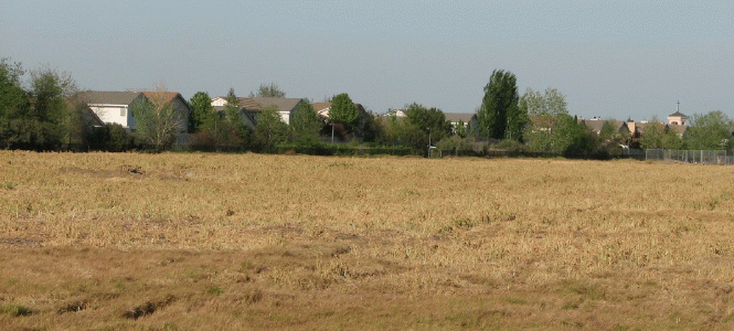
 Over the past several years, the city of Davis has been spending millions through Measure O funds and other Roadway Impact Fees to purchase farmland around Davis with the express purpose of putting that land into a permanent agricultural conservation easement. Such a status protects the farmland and is said to permanently set that land aside as agricultural land, preventing future urban development.
However, the Vanguard received a communication this weekend from Greg House, a local citizen and organic farmer.
In his communication, he writes that the city used roughly $1.325 million of Measure O funds plus another $2.475 million of Roadway Impact Fees to “purchase 390 acres of farmland at the Mace Curve in November 2010 with the stated intention of placing a permanent agricultural conservation easement on the land and then selling it off as permanently protected farmland.”
The decision at this time, according to the staff report, is whether to move forward with the NRCS (Natural Resources Conservation Service) grant which “would permit the Yolo Land Trust to secure agricultural conservation easements on the First Bank of NW Arkansas Property.”
On the other hand, “declining the grant would retain opportunities to explore options to leverage the property for additional or alternative urban agriculture transition area acquisitions, and potential furtherance of local economic development strategies.”
Staff is recommending that the council decline the NRCS grant and explore alternative acquisitions.
Measure O, which was the Open Space measure created from about a $25 per year parcel tax, was approved by the voters of Davis in 2000 and has been used to purchase large swaths of farmland to protect farmland and wildlife habitat around the city.
Measure O itself prohibits the monies from this fund from being used for any other purpose. The City’s Open Space and Habitat Commission (OSH) oversees and advises the city on the use of Measure O funds.
According to Mr. House, “While this Mace Curve farmland purchase was being negotiated, the City entered into an agreement with the Yolo Land Trust (YLT) that YLT would receive and maintain the intended farmland easement, and also that YLT would apply for a grant from the United States Department of Agriculture Natural Resource Conservation Service (USDA-NRCS) Farm and Ranch Land Protection Program (FRPP) to defray half of the cost of the farmland easement.”
He adds, “The FRPP grant program is highly competitive and grants are awarded on a priority ranked basis. YLT was successful in getting this grant for $1,125,000; it was one of only two such grants from the FRPP in the entire State of California during 2011.”
On the consent agenda on Tuesday’s council meeting, staff recommends that the council “[a]uthorize staff to notify the Yolo Land Trust that the city will decline to proceed with NRCS funding for the resale of the First Bank of NW Arkansas Property and further direct staff to explore options to leverage the property for urban agriculture transition area and local economic development strategies.”
According to staff, the Mace Curve Property was acquired by the city in November 2010.
They write, “The Yolo Land Trust, in partnership with the City, received a $1,125,000 Natural Resource Conversation Service (NRCS), grant on April 18, 2011 to permanently protect the farm. The grant amount was 50% of the appraised value of the conservation easement. The actions recommended in this report would allow for the resale of the property.”
As staff notes, one of the General Plan principles calls to: “Create an open space buffer between urban and agricultural uses to maintain the integrity of the adjoining agricultural/natural areas, to serve as a transitional space between urban and rural lands, to provide a visual edge, and to be an aesthetic and recreational resource.”
However, over the past two years, “this area has also been the subject of discussion for non-agricultural uses that could potentially support long term economic development strategies. Specifically, efforts of the Innovation Park Task Force and subsequent City Council actions have resulted in direction to pursue a ‘Dispersed Innovation Strategy’ to accommodate existing and future business development and retention needs.”
Staff notes that in November 2012 the council adopted a resolution which would recognize “that the East and West ‘edge’ sites offer viable options for location and size of larger innovation centers meeting needs of growing midsized companies, and should continue to be explored as part of a mid-term Dispersed Innovation Strategy.”
Staff recommends that the council decline the NRCS grant and explore alternative acquisitions.
They note, “By design, agricultural conservation easements place strict limitations on the use of the property, with a key objective of soil conservation. Pursuing an agricultural conservation easement on this property, while locking in agricultural use, would also limit development opportunities of the land due to strict limitations on surface area used for structures and parking, including placement of greenhouses or research-related facilities.”
They add, “Placing an agricultural conservation easement on the property at this time would narrow the scope of potential opportunities to leverage this land for multiple long term City objectives, including larger and/or alternative urban agriculture transition areas that provide a better ‘lock’ adjacent to the City.”
“Furthermore, leveraging the land could result in potential innovation park uses and related agricultural research facilities consistent with the City Council direction to pursue a Dispersed Innovation Strategy,” staff writes.
They argue that this area presents opportunities not found in other areas of the community, including the proximity to I-80, “the Mace interchange, rail lines, a major bicycle corridor, Second Street, and existing drainage and utility facilities create opportunities to connect with the region and city core and university and to minimize greenhouse gas impacts.”
“Proximity to these existing infrastructure resources, in combination with flexible land configuration options, and adjacent agricultural and open lands, also positions this area well for ‘green’ industry and research companies,” staff argues. “Retaining flexibility for innovation center scalability is critical as successful new facilities that support innovation and technology companies are different from traditional business parks.”
“Two important components in new innovation centers are the ability to draw a critical mass of innovators and to provide ongoing opportunities for informal, interdisciplinary face-to-face interactions,” staff argues.
At this point, staff does not believe there is not enough information to provide details of where acquisitions and easements would be acquired.
Staff believes there is merit to exploring alternatives in the vicinity of the Mace curve.
It is curious that this item, which represents a major departure in city land use and open space protection policies, would be placed on the consent agenda. However, while Mr. House presents the concern that there would be no discussion on the item, items of this nature are routinely pulled in order to allow a full discussion.
He argues that this proposal represents the city “reneging on its agreement with YLT to go through with this farmland preservation agreement, and is casting aside $1,125,000 in hard-won grant money from the US government.”
In so doing, he argues, this goes against the advice of the Open Space and Habit Commission which “strongly recommends that the City follow through with its agreement and formally complete the work it started with YLT, and permanently preserve this 390 acres of land for agriculture. OSH also recommended to the City Council that it set aside 30 acres of this land for community farms and gardens that would give the citizens of Davis public access to open space and farmland.”
Michelle Clark, Executive Director of the Yolo Land Trust has “publicly stated that YLT has grave misgivings about its reputation and ability to qualify for grants in the future if the City reneges on its agreement with YLT to follow through on its commitment to accept this grant.”
He writes, “For several years now the City Council has been meeting in closed sessions to discuss this property. At the OSH Commission meeting of June 4, those attending the meeting learned that several property owner/developers have been discussing with the City the development of a business park on this very site in conjunction with their own adjacent properties.”
Mr. House adds, “The development proposals, of course, are too nebulous to outline in any detail. Instead, the City is greenwashing whatever deal they have cooking with the developers by saying the City is ‘exploring options to implement the Urban Agriculture Transition Areas in a permanent fashion.’ “
—David M. Greenwald reporting


This all seems to go against Measure O and what all homeowners are paying a parcel tax for.
What an interesting trap we’ve gotten into. The outfit that would get paid for maintaining the easement argues we’re destroying their professional reputation if we don’t sell lock up all development rights to the property we own.
What a great local fight this sets up: the no-growthers vs. the business parkers. That many folks are on both sides should make for some fascinating intramural arguments.
The city certainly can limit development as much as and for as long as it wants without easements. This easement, of course, presupposes (and guarantees) that future Davis citizens will have no alternative plans in perpetuity.
…sell off and lock up…
[quote]through [b]Measure O[/b] funds [u][b]and other[/b][/u] [b]Roadway Impact Fees[[/b]/quote]Interesting news on at least two levels… that Measure O funds are considered to be Roadway Impact fees, and that Roadway Impact fees IN ADDITION TO funds acquired as Measure O revenues, are being used to acquire land/development rights… what’s that expression re: “heads rolling”?
I’d like to read the staff report, but the city’s website isn’t responding…
.
David wrote:
> the Vanguard received a communication this weekend
Was it an e-mail, a phone call, did a courier bring a letter?
> Over the past several years, the city of Davis
> has been spending millions through Measure O funds
> and other Roadway Impact Fees to purchases farmland
> around Davis
Any idea where I could find a list of the property that Davis has bought with the millions of dollars? In San Mateo and Sonoma County I’ve noticed that over the years much of the millions to purchase land or pay for conservation easements have gone to politically connected land owners who have either got above market money for crappy land or got paid millions to put a conservation easement on land that they had planned to keep empty anyway.
> The city certainly can limit development as much as
> and for as long as it wants without easements. This
> easement, of course, presupposes (and guarantees)
> that future Davis citizens will have no alternative
> plans in perpetuity.
As a student of California land use I’ve seen the owners of land they want to develop work to push land better suited for development in to land trusts so their land is left as the “only” alternative…
SouthofDavis speaks truth.
What was the time frame on the YLT Conservation easement? These easement usually expire in 25 or 50 years. It looks like the city decided to keep its options open for a shorter duration. There are also, i believe, other areas that have been preserved between here and Woodland and here and Dixon through this process so it looks like the council is recognizing that it will not be too long before all the infill opportunities are developed and Davis will need land on the periphery for development. Seems like a sensible approach to me but I’m not usually bothered by such plans and can see the value added to the community by having an area for post-industrial business development outweighs the historic, aesthetic, cultural, agricultural and economic values of preservation of that area.
This does sound odd, impact fees being used to stop development rather that to construct facilities “needed” because of new developments.
Lots of conservation easements go to farmers who never have any intention of doing anything other than farming their land and don’t want their kids and grandkids doing anything else when they inherit. That’s part of the beauty of the concept: buy rights for reasonably low amounts per acre for large parcels. Farmland, wildlife lands, etc., are assured for decades or forever for relatively little public investment. That’s a good thing.
Whether a city should foreclose all options for land it owns immediately adjacent to its developed borders (and with access to all the public facilities as we have in this area) is a more complicated question. It seems the present council will be looking at possibilities which the council that joined the Trust’s efforts did not foresee.
Maybe the “urban agriculture transition area” concept being recommended now will better meet municipal ag-land protection objectives as well as leave open the possibility of ag-related and other research/business park developments that will support other high priority city needs.
I think, Mr.Toad, that NRCS (USDA’s Natural Resources Conservation Service) contributes only to perpetual farmland protection easements now. The NRCS funding process is a highly competitive one, but I’d be surprised that the highly qualified and regarded Yolo Land Trust has (or needs to have) “grave misgivings about its reputation” and future capabilities should this contract not be completed. Potential partners and landowners drop out at many points in the process.
A strange aspect to this proposal is that current NRCS regulations require private ownership in order to be eligible for consideration. Obviously, publicly owned land already is “locked up” for public good. So, why would government money be needed to assure public benefit? There must be more to this arrangement than is reported here.
RE: SouthofDavis: “As a student of California land use I’ve seen the owners of land they want to develop work to push land better suited for development in to land trusts so their land is left as the “only” alternative… “
The broker who worked with City Staff member Mitch Sears on the purchase of the “Arkansas property” was developer Tim Ruff. Ruff is a partner with John Whitcombe on the Nishi proposal and the point person in their dealings with the City. SouthofDavis make very a good point.
Might be interesting to review the Form 700 report for City staff involved in the open space acquisition program.
Side bar… might be interesting to disclose Form 700 forms for the CC members, particularly those who have announced that they intend to seek ‘higher office’.
[quote] … staff recommends that the council “[a]uthorize staff to notify the Yolo Land Trust that the city will decline to proceed with NRCS funding for the resale of the First Bank of NW Arkansas Property and further direct staff to explore options to leverage the property for urban agriculture transition area and local economic development strategies.”[/quote]
The council [u]should not approve this recommendation[/u], but should instead proceed with the planned preservation of the property as farmland.
[i]The council should not approve this recommendation, but should instead proceed with the planned preservation of the property as farmland.[/i]
I think farmland is over-rated when there are other uses that provide benefits to the general population. Land is a natural resource. All natural resources require conservation, but having a goal of 100% conservation is silly.
If the city is really interested in developing business uses east of Mace — a line it has long resisted crossing — it should look at the Bruner and Ramos parcels, which together comprise about 180 acres. They’re much better situated with respect to Mace/I-80/UPRR, have the same access to utility infrastructure, and are surrounded by the Arkansas parcels that would serve to limit the temptation to continue sprawling north and east.
I think the staff recommendation is not a good idea, and I hope the council rejects it.
.
[quote]having a goal of 100% conservation is silly.[/quote]
Yes, it would be silly. But that isn’t anything I’ve ever advocated, obviously.
Too many questions to proceed with any perpetual agreement yet. There’s certainly no rush if the city already owns the land. This easement contract would be one decision that never can be revisited once it’s done. Has there been much public input with the present council or during the Open Space and Habit Commission evaluation?
Strange that a topic with as much built-in controversy as this staff proposal would show up on the consent calendar. (Unless council members have hashed this out with staff in all the closed sessions and just need to ratify their decision. Maybe it’s already a one deal.)
Don, you always have the useful land use links. Got anything on surrounding ownership and/or existing easements? Thanks.
“The council should not approve this recommendation, but should instead proceed with the planned preservation of the property as farmland. “
Why?
David wrote:
> According to Mr. House, “While this Mace Curve
> farmland purchase was being negotiated,
Are we talking about just the inside/west side of the “Mace Curve” or are they looking to buy land on the outside (north and east side) of the Mace Curve?
Then Hawthorne wrote:
> The broker who worked with City Staff member Mitch
> Sears on the purchase of the “Arkansas property” was
> developer Tim Ruff. Ruff is a partner with John
> Whitcombe on the Nishi proposal and the point person
> in their dealings with the City. SouthofDavis make
> very a good point.
If I owned a piece of land that was hard to get to (just think of 500 cars a day driving down Olive Drive or even worse through the Richards tunnel, on to campus to get behind Solano Park to wait for the crossing gate for them to open so they could get to work) I would not want the owners of a piece of land near the big modern Mace exit (that already had a train track overpass) to have any chance of developing the land…
[quote]Don: “The council should not approve this recommendation, but should instead proceed with the planned preservation of the property as farmland. ”
Mr Toad: Why?[/quote]
I’ve answered that question many times on other threads on which you’ve participated.
[quote]I would not want the owners of a piece of land near the big modern Mace exit (that already had a train track overpass) to have any chance of developing the land…[/quote]
Nishi is likely to go forward long before anything could ever happen on Mace.
[quote]Are we talking about just the inside/west side of the “Mace Curve” or are they looking to buy land on the outside (north and east side) of the Mace Curve?[/quote]
The land in question doesn’t actually touch Mace Boulevard, though it comes close at one point. It comprises 3 parcels, contiguous in a sort of zigzag fashion, that lie east of Mace. The largest is adjacent to the west side of Howat Ranch, and is 1/2 mile east of Mace Boulevard.
.
Jim Frame, does the city already own this land or are “they looking to buy it?” If we own it or have funds to buy it, what is the purpose in giving up our rights to use it as the city sees fit, now or in the future?
The city can choose to leave it in agriculture without an easement in place. The amount of one-time cash we’d get wouldn’t be much for what we’d give up.
[quote]The amount of one-time cash we’d get wouldn’t be much for what we’d give up.[/quote]
My understanding is that the city owns the parcels. Once the conservation easement is in place the city would sell the underlying land to be farmed, while YLT would retain the easement. The city would then roll the sale proceeds (unencumbered value minus the easement value) into future conservation purchases.
.
Unless there’s a loophole I’m not aware of, developing these parcels would require a Measure J/R vote, so I can’t see why the council would want to reverse course on its conservation program given the resistance that would bring about. The risk/reward ratio seems awfully big to me.
The city is set to throw away over a million dollars in grant money and the hard work of the Open Space & Habitat Commission and the Yolo County Land Trust, in order to build an “innovation park” (while pretending to be concerning about an agriculture buffer) on land that was purchased with taxpayer money that was designated to be used for maintaining open space. This is all while Davisites have been crystal clear about their feelings about expanding the borders of the city into surrounding agricultural land.
Davisites should show up in force at the Tuesday Council meeting to protest this travesty.
[quote]Unless there’s a loophole I’m not aware of, developing these parcels would require a Measure J/R vote, so I can’t see why the council would want to reverse course on its conservation program given the resistance that would bring about. The risk/reward ratio seems awfully big to me.[/quote]
Yes, this is exactly right.
“The council should not approve this recommendation, but should instead proceed with the planned preservation of the property as farmland.”
I thought you might have a reason to back up your position.
So here is the deal. The City owns the land. Doing the land trust deal and taking the Feds money ties the hands of the City going forward. The City is actually being prudent by not limiting its options for future generations.
“The City is actually being prudent by not limiting its options for future generations. “
Well I guess that would depend on how one defines prudence. I was told at one point that the city if it ended up developing a business park east of Mace would have to cut a deal where it puts adjacent land into conservation easement. The problem at this point is that if the city pulls out of this easement, they seem to lose credibility to cut that sort of deal. That means that what may seem prudent to you and now, might actually make it more difficult to get the land entitled and through a measure R vote.
Thanks, Jim. The city council packet site now is accessible. The staff report/recommendation is enlightening:
http://city-council.cityofdavis.org/Media/Default/Documents/PDF/CityCouncil/CouncilMeetings/Agendas/20130611/04H-Mace-Curve-Urban-Agriculture-Transition-Area.pdf
Re. hpierce’s issue, the road impact funding is referred to as a loan. This $2.5-million would seem seem to be headed for repayment to fund projects for which it was designed. Will that be as soon as the property is resold or further down the road? And, how much will be left after the city pays two or three percent commission to the broker selected to handle the deal?
Apparently, the Trust already has received the federal money and would have to return it if the easement deal doesn’t go through. The urgency of the council decision is apparent: the Trust is facing a go-no go deadline in less than a week. Nice that the council gets all this time to decide, assuming that it hasn’t already made its decision during executive sessions.
The staff report doesn’t deal with how public property even got considered eligible for a private land conservation easement program in the first place.
Sorry the link doesn’t show as it was pasted. (It’s from the city council agenda site.). By the way, the report includes great maps showing location and ownerships.
Here’s the link:
[url]http://citycouncil.cityofdavis.org/Media/Default/Documents/PDF/CityCouncil/CouncilMeetings/Agendas/20130611/04H-Mace-Curve-Urban-Agriculture-Transition-Area.pdf[/url]
Jim wrote:
> The land in question doesn’t actually touch Mace
> Boulevard, though it comes close at one point. It
> comprises 3 parcels, contiguous in a sort of zigzag
> fashion, that lie east of Mace. The largest is
> adjacent to the west side of Howat Ranch, and is
> 1/2 mile east of Mace Boulevard.
The mention of “Howat Ranch” reminded me that a while back I read that Randy Yackzan and his son in law Gregg Herrington were planning some kind of solar facility on the (city owned) Howat Ranch. I found the Enterprise article below and some city council stuff from 2010, but nothing since then on line. Any idea if solar “farming” is OK with a conservation easement?
http://www.davisenterprise.com/Archived-Stories-0/city-council-plants-some-solar-seeds/
[quote]Don: “The council should not approve this recommendation, but should instead proceed with the planned preservation of the property as farmland.”
Mr. Toad: I thought you might have a reason to back up your position.
So here is the deal. The City owns the land. Doing the land trust deal and taking the Feds money ties the hands of the City going forward. The City is actually being prudent by not limiting its options for future generations.[/quote]
Ok, I’ll keep it simple. Prime farmland that is next to prime farmland shouldn’t be developed if your goal is to prevent the development of prime farmland.
Tying the hands of the city is exactly the purpose: preventing the development of prime farmland by putting restrictions on doing anything with it other than farming it.
It would be spectacularly irresponsible for the city council to accede to the staff report. In fact, I’m rather blown away that any city staff are proposing this at all.
What’s the purpose of the taxpayer paid for buffer if it can be moved farther and farther out at the city’s whim? This comes across as someday we will have a buffer when the city decides it doesn’t want to grow anymore. The city needs to use our parcel money for how Measure O was presented to us in the first place and quit playing games.
“Tying the hands of the city is exactly the purpose: preventing the development of prime farmland by putting restrictions on doing anything with it other than farming it.”
This is the position of those who don’t trust our elected leaders (present or future) to the “right thing,” whatever that might be given the present majority opinion. It also assumes the “right thing” will remain the same for eternity. Why should the city purposely tie its own hands when it has complete control to keep its land in agriculture as long as it meets our city’s objectives.
It was spectacularly irresponsible for the city council to pursue this scheme in the first place.
History has shown that such easements are needed to tie politician’s hands, or agricultural and other open space that benefits everyone is lost forever. The siren call of developer money is too strong to resist otherwise. Indeed, we’re seeing some respond to it right now. This is not about keeping options open. This is about an “innovation park” on an expanded Davis border.
.[quote]It was spectacularly irresponsible for the city council to pursue this scheme in the first place.[/quote]
It was the voters who pursued it, in the interest of being responsible.
[quote]It was spectacularly irresponsible for the city council to pursue this scheme in the first place.[/quote]
I’m not sure I understand what you’re saying. That it is irresponsible for the city to pursue policies that preserve and protect ag land?
But here is the problem. If you lock this land up and in the future you need to develop that area you end up with leap frog development, something, i think most agree, is the worst kind of development. It is better for the future of Davis to be able to develop this land if needed and take the profit to buy land farther out that will be less valuable. The idea is to preserve open space not lock Davis into a bad planning situation forever but demanding that today’s frontier be saved no matter what the future holds.
is every decision now going be subject to accusations of double dealing because Dan and Joe are seeking higher office? Money is only one part of running for office. Popular support through the implementation of good policy is just as important. Just ask Meg Whitman.
“Ok, I’ll keep it simple. Prime farmland that is next to prime farmland shouldn’t be developed if your goal is to prevent the development of prime farmland.
Tying the hands of the city is exactly the purpose: preventing the development of prime farmland by putting restrictions on doing anything with it other than farming it.”
Fine but shouldn’t the people of Davis, through their elected representatives, decide if land preservation for the sake of maintaining commodity production is the highest and best use of our land resources?
[quote] you end up with leap frog development[/quote]
Which is exactly what the staff proposal is for: leapfrog development. None of the parcels under consideration is contiguous with existing city limits. Development of any of them — the most logical one being the 230-acre piece next to Howat Ranch — would leave large ag parcels between the new development and the existing city limits.
.
Is anyone considering development at this time? It seems the city is keeping their options open for some time in the future when this would not be leap frog.
This isn’t about preserving options; the city can’t afford to preserve options like this, not when it means locking up millions of dollars by sitting on almost 400 acres of land for decades waiting for the intervening parcels to develop. This is about near-term economic development, which is fine unless it means contravening policy and the will of the electorate, promoting leapfrog development, and jilting YLT.
.
[quote]Fine but shouldn’t the people of Davis,[s] through their elected representatives,[/s] decide if land preservation for the sake of maintaining commodity production is the highest and best use of our land resources?[/quote]
The voters passed Measure O 70.4% to 29.5%. I think the voters have made their preferences clear.
Yes, they want open space, but do they want the land locked up forever foreclosing options for the future. I hope the people of Davis have enough faith in the people they elect to manage the open space.
No farmer is getting paid to continue farming. The Yolo Land Trust will pay Davis the $1.125M for the conservation easement. The City will turn around and sell the land for agriculture as encumbered with the easement, and more or less break even, having done the work that Measure O funds.
The conservation easement is perpetual; that’s the point.
There are 3 key issues in my mind:
1) Transparency: the citizens need to know what is going on with their Measure O money (and it should be used only for the intended purpose, not speculation on future economic growth).
2) Good faith dealing: the City made an agreement with the Yolo Land Trust 2 years ago to go after this grant and conserve the land. The City now must make good on this agreement, or it will be giving the shaft to its 20 year partner in conservation.
3) Reputation: both the City and YLT will have a hard time in getting grants in the future with this reneging of a grant THEY applied for.
What makes you so sure?
One, this story just broke but many here have reached conclusions without the information that the council has, and I think its fair to assume they have more information than we do.
Two. How do you know that YLT feels betrayed? Have they made any statements to this effect?
Three. Why do you think that returning unused money will damage the ability to do deals in the future?
[quote]Three. Why do you think that returning unused money will damage the ability to do deals in the future? [/quote]
Ever been involved in processing grant applications? It’s not a trivial undertaking, especially when millions of dollars are involved. Staff time costs real money, and agencies don’t like to waste it. They tend to look askance when an approved applicant says, “Never mind, we found something better to do.”
Sure in general, but do you have any information that suggests the Feds aren’t Okay with this particular deal falling through?
My guess is that NRCS isn’t even aware that rejection of the grant is under consideration.
My guess is they sigh and give the money to the next applicant who will be happy to get it.
By the way, i once walked on a real estate deal because the inspection revealed a structural problem. Didn’t hurt my ability to do the next deal at all.
[quote]”It was spectacularly irresponsible for the city council to pursue this scheme in the first place.
“I’m not sure I understand what you’re saying. That it is irresponsible for the city to pursue policies that preserve and protect ag land?” [/quote]There’s nothing wrong with the city partnering in efforts to maintain agricultural uses of surrounding land–even though this high purpose really is directed at stopping growth in selected surrounding areas. The community now supports the no-growth in peripheral areas.
The irresponsibility to which I’m referring lies in the scheme to make today’s good decisions irrevocable into eternity by entering into a perpetual easement. The offensiveness breaks into two parts:
1. The presumptuousness of making a land use decision that cannot be revisited by citizens or their leaders in the year 2050 or 2078 or 3080 or anytime in the future. Why do we think we know what will be best for Davis long after our deaths?
2. The arrogance and bad spiritedness being reflected in the support for this move: We cannot trust our own elected leaders to make decisions in our interests!
Hope that clarifies. We agree on the value of agricultural land, even if we’re on different sides of this easement matter. I do think that the ag land value could become less important by comparison to other community needs in the future. I think it’s important to allow future generations to make the call.
[i]The problem at this point is that if the city pulls out of this easement, they seem to lose credibility to cut that sort of deal.[/i]
I don’t believe this is true. When the city needs to enter into a conservation easement after they develop this tract, they will simply donate the easement…no funds from NRCS will be required.
[i]My guess is that NRCS isn’t even aware that rejection of the grant is under consideration. [/i]
Since NRCS has an office in Davis, my guess is that they are very, very aware of what is going on.
[i] Good faith dealing: the City made an agreement with the Yolo Land Trust 2 years ago to go after this grant and conserve the land. The City now must make good on this agreement, or it will be giving the shaft to its 20 year partner in conservation. [/i]
The citizens of Davis have clearly shown that they do not care about reneging on agreements — thousands of them voted against and water project, for which the city had been working with Woodland on for more than 10 years. In this case, it is no reason to continue with the transaction if the city doesn’t believe that doing so is in its best interest.
YLT will survive just fine. They will be able to push this off on the city of Davis and a change of city council members. Happens all them time with municipalities.
[quote]MT: “Sure in general, but do you have any information that suggests the Feds aren’t Okay with this particular deal falling through?
…
JF: My guess is that NRCS isn’t even aware that rejection of the grant is under consideration.[/quote]JF’s well-meaning guess is refuted by NRCS’s comment in the staff’s report.
And, this program is not like your run-of-the-mill grant request program. Many of these perpetual easement efforts never come to fruition. All partners know that landowners have changes of heart (or die) during the process.
There’s no evidence that this affects future relationships between the agency and non-profits who work together to implement the Farm and Ranch Lands Conservation Program.
First, the organizations involved (such as the Yolo Trust) go through rigorous qualification reviews to even be able to sponsor applications. Second, ranking and selections for federal funding are based on merit of the applications, not some “relationship” issue.
The argument that the Yolo Trust or the city will jeopardize potential future NRCS projects if we don’t proceed simply is a supporter pressure tactic and is without merit. The council’s decision should be based on the other considerations folks have offered up (and any of the things we don’t know about because they’ve been discussed at the executive meetings).
[quote]The argument that the Yolo Trust or the city will jeopardize potential future NRCS projects if we don’t proceed simply is a supporter pressure tactic and is without merit.[/quote]
I don’t agree that it’s without merit, but I do agree that it’s more of a pressure tactic than an unmitigable disaster.
[quote]”But here is the problem. If you lock this land up and in the future you need to develop that area you end up with leap frog development, something, i think most agree, is the worst kind of development.”[/quote]As I view the map, the property under discussion–along with the other city parcels and adjacent private land–would comprise significant “peripheral development,” but not “leapfrog development,” if all are developed over the years.
If this parcel is put into perpetual easement, it certainly would have to be leapt over if nearby land gets developed. The leapfrog danger I’d worry about would come from the county approving developments on nearby land that we no longer can protect without the millions of pass-through dollars we’ve been sending to Woodland.
[quote]”I don’t agree that it’s without merit, but I do agree that it’s more of a pressure tactic than an unmitigable disaster. “[/quote]Okay, I can understand how some might come up with such a fear. I’m just pointing out that it’s an illogical one, that it won’t happen and, therefore, the pressure tactic isn’t really a fair argument to continue to use. Nobody should lose any sleep over the worry.
[quote]One, this story just broke but many here have reached conclusions without the information that the council has, and I think its fair to assume they have more information than we do. [/quote]
If House = Greg House, then he is on the Open Space & Habitat Commission and so has quite a bit of information about the parcel, its farming potential, the plans for a community farm, the effort to get the grant and the easement, the relationship to the YLT, etc. — i.e., possibly more information than the Council itself.
Hmm, davisite4, that might explain a lot about this comment:[quote]”3) Reputation: both the City and YLT will have a hard time in getting grants in the future with this reneging of a grant THEY applied for.” [/quote]Just catching up with the [i]Enterprise[/i] story on this matter and its more complete reporting directly contradicts this contention and puts the whole scare tactic in perspective:[quote]’Yolo Land Trust Executive Director Michele Clark said Monday that she’s disappointed that city staff has moved in this direction, but she understands the city’s leadership has changed over the past few years and that ‘these things happen.’
Greg House, a Davis resident who is concerned about the city pulling back on its intention to preserve the land, said in an email to [i]The Enterprise[/i] that Clark had ‘grave misgivings about (the trust’s) reputation and ability to qualify for grants in the future’ if the city declined the funding.
But Clark said she’s been assured by USDA officials that even if the plan falls through — a project that received a substantial portion of the funding available in the state for conservation easements — future funding applications will not be affected.”[/quote]I understand that a commission member would be devoted to this project, but it’s time to put this argument to rest for good and discuss the proposal on its merits.
Ms. Clark was being politic, not wanting to alientate a major partner. But I wonder how many hours YLT staff sunk into preparing and administering the grant application, and how many city staff and consultant dollars went into it. Having been involved in a bunch of these, and getting only a glimpse of the total from my limited participation, I expect it amounts to a tidy sum.
Are you really suggesting that Ms. Clark is not telling the truth out of fear? That we should believe what House writes about her rather that what comes out of her own mouth?
I know this fear-mongering is not legitimate; trust me. These three partners will jump at the next opportunity that comes along, without regard to whether this one goes through.
Of course, you’re correct that multi-million-dollar projects cost time and money in developing plans and proposals. Many do not become reality because, as she notes in her disappointment, “these things happen.” Participants in developing perpetual easements know this is just the cost of doing business.
There’s a lot of legitimate points to discuss about this project. Time to focus on them. The fact that the council is left with less than a week to decide this in public makes the public debate difficult. I just searched the [i]Vanguard[/i] and [i]The Enterprise[/i] sites to see what I missed in the coverage of this over the past two years. Guess what?
[quote]1. The presumptuousness of making a land use decision that cannot be revisited by citizens or their leaders in the year 2050 or 2078 or 3080 or anytime in the future. Why do we think we know what will be best for Davis long after our deaths? [/quote]
Napa County voters, in 2008, extended their ag protection measure by 50 years. I’d accept that limitation.
[quote]2. The arrogance and bad spiritedness being reflected in the support for this move: We cannot trust our own elected leaders to make decisions in our interests! [/quote]
It only takes three votes on a council to make a terrible decision with far-reaching consequences. So you’re right: we cannot trust our elected leaders to make prudent land-use decisions. Especially when there is staff planning activity going on behind the scenes, undermining the express will of the voters. And a full-court press of about three years duration, at least, to get peripheral land annexed and developed. Peripheral task force, DSIDE, recent op-ed by the new CIO: it all points to the same plan. This is just another part of the process. It is time for a clear urban limit line, and a clear message to the peripheral landowners.
This proposal would be the worst sort of urban planning, it would violate the intent of the voters, it violates Yolo County’s policies about ag land.
JustSaying, read the staff report. Even it admits: “The City would lose the NRCS money and potentially affect successful procurement of future NRCS grants (although NRCS has denied that this would be the case).” — I don’t know where that last clause comes from.
So, this is not just coming from Greg House.
More from the staff report, “The Yolo Land Trust, in partnership with the City, received a $1,125,000 Natural Resource Conversation Service (NRCS), grant on [b]April 18, 2011[/b] to permanently protect the farm. “
Also, “Fee-title of the 390 acre Mace Curve Property was acquired by the City in November 2010 from the First State Bank of NW Arkansas for the negotiated purchase price of $3,800,000.”
In other words, the Council has had plenty of time (over two years!) to make this decision; [b]it’s down to the wire because of the Council’s own delaying[/b]. It is “interesting” that such a big decision is being made so quickly, without discussion, ignoring the opposing input of the OSHC entirely by placing this as a consent item on the agenda, as though it were not controversial (“On June 3, 2013 the Open Space and Habitat Commission voted unanimously to affirm their recommendation that the City proceed with the NRCS Grant”).
Other disadvantages listed in the staff report of declining the NRCS grant:
– real estate acquisition or development concepts are always speculative
– there are many unknowns about option details at this point in time and exploration and vetting of concepts will be necessary
In other words, there is no plan for an ag buffer around Mace Curve, no guarantee of an “innovation park” which would likely be rejected in Measure J/R vote anyway… just pie in the sky, loss of an opportunity to preserve agricultural land, and over a million dollars in the toilet.
“JustSaying, read the staff report. Even it admits: ‘The City would lose the NRCS money and potentially affect successful procurement of future NRCS grants (although NRCS has denied that this would be the case).’– I don’t know where that last clause comes from.”
I read the staff report. I didn’t say the fear talk came only from Greg House (he’s just the most out-front spokesman); it’s been going on all day with others, too. You know where the NRCS denial comment came from, the same place that the rest of the statement came from.
So, we have the Yolo Trust denying that such action would affect the relationship or future projects; we have NRCS doing the same; and, we have the city staff acknowledging a potential for which they immediately offer the federal agency’s assurances. Good enough for me.
But, I’m with you on the strange public behavior of the council on this matter. We can’t blame it on the innovation guy–he just showed up. What’s been going on with this project for the past two years? How long has the private discussion of the alternative approaches been going on, and why didn’t the rest of us get to hear about it until this late date?
There are a lot of moving parts in this situation. Many of those moving parts went into motion after the November 2010 date when the property was acquired. The Central Valley Flood Protection Plan did not exist at that time. The Bay Delta Conservation Plan was still going through growing pains. The bursting of the Housing Bubble was yet to hit bottom in 2012. The expectations of the recovery from the “Great Recession” were still overly optimistic.
The fact that Council is taking the time to thoroughly and properly assess those moving parts is both good decision making and good government. Don’s argument that, “This proposal would be the worst sort of urban planning, it would violate the intent of the voters, it violates Yolo County’s policies about ag land,” fails to take into consideration that many of those voters have had to tighten their belts and/or move out of homes that they owned because of changes in their economic circumstances. Many of those voters have lost their jobs and are looking at life through very different eyes than they did when they exercised their vote on this issue.
In my opinion Council should not rush to judgment without making sure that they understand the consequences of any action they take.
JustSaying said . . .
[i]”But, I’m with you on the strange public behavior of the council on this matter. We can’t blame it on the innovation guy–he just showed up. What’s been going on with this project for the past two years? How long has the private discussion of the alternative approaches been going on, and why didn’t the rest of us get to hear about it until this late date?”[/i]
I really don’t see the Council’s public behavior as “strange.” They appear to be processing the information as it comes to them. This is a group that has shown that they do not have to be held captive by past decisions that either are or have the potential to be economically damaging to the City’s fiscal health. Just ask Bobby Wiest. The Surface Water Plant has been downsized from 18 mgd to 12 mgd. They may even get the Wastewater Plant Upgrade RFQ process right and save Davis citizens another $47 million NPV. Their behavior isn’t strange. Over the past 12 months it has been well considered and rather prudent.
Matt, I’m not commenting about the council actions except this one. I would hope that this information isn’t just coming to them less than a week before the settlement deadline, only to show up on the consent calendar when it’s obvious that it pits the staff (and council?) against a dedicated and determined commission.
I’m quite pleased with our current council’s actions, including the ones you’ve listed. I’ll also agree if it turns out that they’ve quietly been considering the prudent path for this project and vote to skip the unnecessary perpetual easement. It’s just too bad that it comes with so little time to have public discussion.
The contention that such a decision somehow would violate the expressed public will doesn’t seem reasonable or accurate. Neither the measure nor the county ag land policies require the use of perpetual easements as a tool to protect farmland or to restrict development. The council can meet current city and county objectives without foreclosing the possibility that changing conditions might call for a different decision one hundred years or more down the road.
“Napa County voters, in 2008, extended their ag protection measure by 50 years. I’d accept that limitation”
But is 50 years on the table?
[quote]The contention that such a decision somehow would violate the expressed public will doesn’t seem reasonable or accurate.[/quote]
It’s not only reasonable and accurate, it is an understatement. The goal of this process is a business park east of Mace. I’m sure the property owners are happy to see you focusing on process, and using emotional arguments about fairness and trust. But I’m sure their eyes are still on the ball: peripheral annexation and development of their prime farmland.
[quote]But is 50 years on the table?[/quote]
My point is that if a councilmember wished to amend the ag protection to add a sunset clause, I wouldn’t object to that. I don’t care if it’s on the table or not. Developing east of Mace should be off the table, now and for the foreseeable future.
Yes, I am Greg House, local boy who has worked in agriculture as an agricultural consultant and farmer for 40 years, served on the YLT Board of Directors for 9 years, on City of Davis OSH Commission for 7 years. This long time in agriculture has familiarized me with the rural mind. It is moves such as we have witnessed here—a fast one, if you will—that sadly characterized Davis to the rest of the county as self-serving, double-dealing, and not to be trusted.
Yes, dash it, good faith in agreements is important to me. I expect that our City Council would handle the affairs of the City in good faith. An agreement was made in 2011 to conserve the 390 acres. Change of mind? Want to speculate on development in the long run out there east of Davis? This reverses what has been a long-standing Davis commitment which seeks to limit growth and protect agriculture.
What is unique agriculturally about these 390 acres is location. Proximate to the city, it is ideal for the establishment of community farms and gardens. The OSH has been working on this concept—at the vocal urging of several City Councils, I might add—for over 6 years. Read the minutes. Read the reports, the white papers, watch the archived videos of the Council meetings. It is high time for us to recognize that agriculture CAN BE the highest and best use of land as well as a community asset.
Don’t forget too that any urban or industrial development out there would require the approval of Yolo County, LAFCo, and the citizens of Davis via Measure J. Speculation? Hmm…
In any case, the City MUST follow the rules of its own Measure O. Land bought with Measure O money—even part of it—must be used for open space. It’s the law. Times are tight. Presumably this is at least one motivation for the Council’s interest in industrial development at the Mace Curve. Where will the City get the $1.325 million to repay Measure O without the grant? When? How? Ought that be with interest?
If the City Council votes to renege on its agreement with YLT and refuse the grant, then it should make good on the Measure O money by dedicating 135 acres of the 390 acres as OPEN SPACE for COMMUNITY FARMS AND GARDENS (135 acres is the approximate amount of acres the $1.325 million bought). A public apology to YLT would be proper, as well.
[quote]fails to take into consideration that many of those voters have had to tighten their belts and/or move out of homes that they owned because of changes in their economic circumstances.[/quote]
So we should abandon our planning principles? I don’t follow your logic, Matt.
“My point is that if a councilmember wished to amend the ag protection to add a sunset clause, I wouldn’t object to that. I don’t care if it’s on the table or not. Developing east of Mace should be off the table, now and for the foreseeable future.”
Now and the foreseeable future is fine with me. Forever is not.
That’s my point, and the current proposal would be binding in perpetuity. We presume to decide for all generations to come that a community garden is a higher community need and value than some other use. I’m not focusing on process or making emotional arguments about fairness and trust. I’m simply saying it doesn’t make sense to impose a permanent solution on a situation that could be different in 100 years.
We’re all for prime farmland conservation. It would be easy to weigh the values of this proposal if this only was a discussion about ag land needs for the foreseeable future. In Davis’ case, however, this really is all about stopping development forever. Talk about emotional!
“It is moves such as we have witnessed here—a fast one, if you will—that sadly characterized Davis to the rest of the county as self-serving, double-dealing, and not to be trusted.”
Please.
I certainly respect your work and commitment on these matters, both as a Yolo Trust director and a city commissioner. I wonder why the commission pursued a perpetual easement arrangement rather than some kind of agreement with a sunset that would allow for reconsideration based on conditions in, say, 50 years?
I also agree that the city would owe YLT a big time apology. Was the commission aware that the city started entertaining alternatives “several months ago”? What led the commission to act on this again at its last meeting?
I’m sure it’s not impossible to cancel a conservation easement. It should be difficult, and should entail significant costs. But I’m reasonably sure it’s not impossible. Nothing is forever.
This pertains to cancellation or exchange of Williamson Act conservation easements, but I think you can get the idea: [url]http://www.consrv.ca.gov/dlrp/lca/easement_exchanges/Pages/index.aspx[/url]
Don Shor said . . .
[i]”So we should abandon our planning principles? I don’t follow your logic, Matt.”[/i]
Don, as I read today’s article it appears that the same number of acres are being protected, just on the Shriners property north of Covell to the east of Wildhorse rather than on the land adjacent to I-80. So I don’t think we are abandoning our planning principles at all.
How often do “innovation parks” or other business areas get torn up and reconverted to farmland? I believe the answer is “almost never” (maybe “never ever”). Those arguing for this alternative don’t realize that building on this site also forecloses other options.
[quote]Was the commission aware that the city started entertaining alternatives “several months ago”? What led the commission to act on this again at its last meeting?[/quote]
If you look at the materials from the last OSHC meeting, you will see that this was placed on an “informational” item on their last agenda. In light of the information presented, the Commission obviously felt the need to say that its view of the situation had not changed, i.e., that the City should proceed with the grant that the YLT had obtained.
Also note that the staff report that the OSHC was presented with does not say anything about the “land swap” that is mentioned in the article that David published today — which is, to say the least, odd.
Don, I’d tried to show in comments for today’s story on this matter how the NRCS program differs from state programs and, indeed, pays for permanent permanent contracts. That’s the problem with entertaining this program for this property. I have concluded that you and House and others want to have this be an irrevocable decision. I don’t think a city government is responsible in making something permanent based on current needs and wishes. Wouldn’t a 75-year maximum be reasonable?
davisite4, what I’m really asking is whether the council rep and staff inform the commission about the staff recommendation and the commission then “took a stand” opposing that direction?
Your observation about the permanent nature of development is a good one. “Almost never” is the correct option. I wrote up a project on Maui where an air base was converted back to agriculture. It looked like the cannery site times ten before and waving fields of sugar cane afterwards.
As I said, 50 years would be fine. Various ‘orderly growth initiatives’ have passed in Solano and Napa counties, and they have had sunset provisions. That’s fine with me. But I don’t think it’s essential. If it’s the compromise necessary to move forward, fine.
If it’s irresponsible on this site, as you seem to be saying, then is it always irresponsible to do an ag conservation easement? This isn’t the first one for Davis. Just the first one with an active development proposal on the table that I’m aware of.
[quote]davisite4, what I’m really asking is whether the council rep and staff inform the commission about the staff recommendation and the commission then “took a stand” opposing that direction? [/quote]
The document that the OSHC received is here:
[url]http://city-council.cityofdavis.org/Media/Default/Documents/PDF/CityCouncil/Open-Space-and-Habitat-Commission/Agendas/20130603/04-Mace-Curve-Property-Acquisition-Resale.pdf[/url]
As you can see, it contains very little detail and no staff recommendation.
[quote]”If it’s irresponsible on this site, as you seem to be saying, then is it always irresponsible to do an ag conservation easement? This isn’t the first one for Davis. Just the first one with an active development proposal on the table that I’m aware of.”[/quote]Do you have an example of any existing perpetual easements that involve the city of Davis?
I’m really sorry I picked up your “irresponsibility” comment to oppose your point at the time. Getting past that, why do you bring up conservation easements (which I’ve said I support) when my objection is putting public land at the city limits into a [u]permanent[/u] easement.
I trying to say it’s [s]irresponsible[/s] unwise to put this site into a undevelopable condition forever by a decision today. It might be [s]responsible[/s] wise to put this site or any other parcel into an ag conservation easement. It’s the length of the decision’s impact.
I realize the whole idea of using a perpetual easement is to keep anyone from changing the alleged will of 18,023 voters in the year 2000. But, why wouldn’t the will of, say, 30,000 voters in, say, 2060 be allowed as a legitimate way for the city to act.
Just wanted to say that Michelle Clark came to the OSH meeting on June 4 and did express her (and YLT’s) great concern over the potential reneging, and how it would affect YLT’s reputation and ability to get grants in the future.
That NRCS has reassured YLT and Davis there is no hard feeling came sometime in the last 2 days. I’m glad it did.